Glyphosate use in San Joaquin County, California
Reported farm glyphosate use in San Joaquin County, California was 371 pounds per square mile of county land in 2019, higher than 88% of US counties.
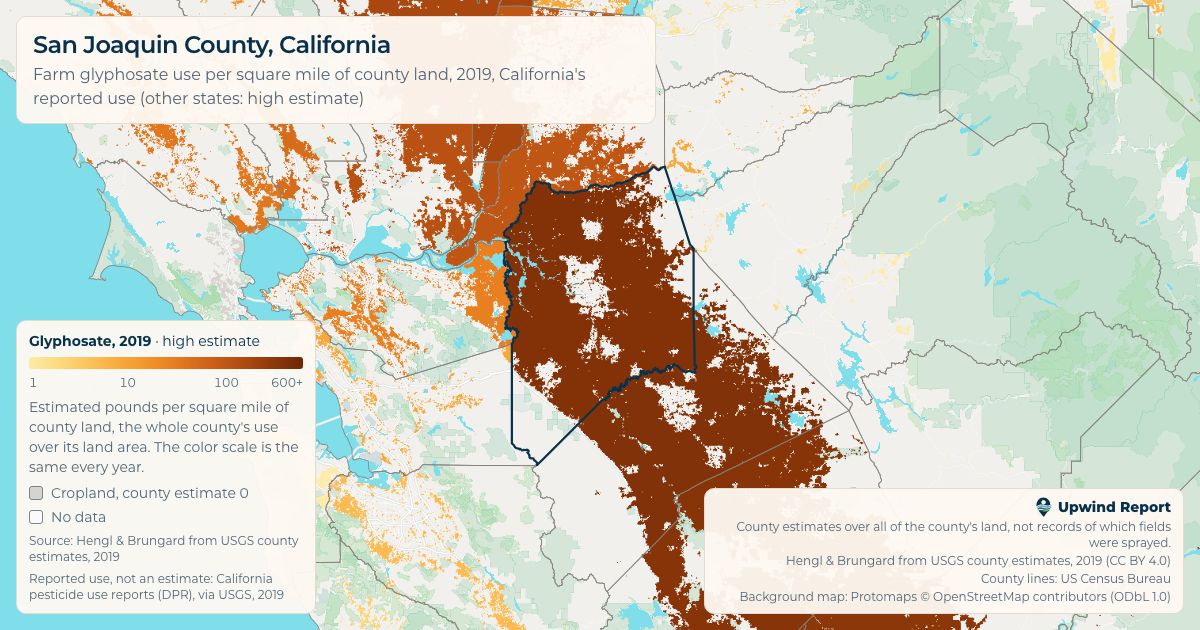
2019 numbers
- US
- 368th of 3,060
- California
- 3rd of 56
Ranks are by use per square mile of county land, on the 2019 high estimate, among US counties with a value. Counties with the same value share a rank.
Share image
A picture of San Joaquin County against the US county median, with the source, to post or send.
Since 2000
Up from 95 in 2000 to 371 in 2019. Pounds per square mile of county land, high estimate.
Every year's numbers
| Year | Low | High |
|---|---|---|
| 2000 | 95 | 95 |
| 2001 | 69 | 69 |
| 2002 | 91 | 91 |
| 2003 | 104 | 104 |
| 2004 | 116 | 116 |
| 2005 | 133 | 133 |
| 2006 | 150 | 150 |
| 2007 | 159 | 159 |
| 2008 | 124 | 124 |
| 2009 | 172 | 172 |
| 2010 | 189 | 189 |
| 2011 | 210 | 210 |
| 2012 | 215 | 215 |
| 2013 | 279 | 279 |
| 2014 | 284 | 284 |
| 2015 | 301 | 301 |
| 2016 | 297 | 297 |
| 2017 | 298 | 298 |
| 2018 | 315 | 315 |
| 2019 | 371 | 371 |
About these numbers
The main number is the county's estimated farm glyphosate use for the year divided by all of its land, water left out. A county with a little farmland can use a lot per square mile of cropland and still have far less in total than a county with more farmland, so the whole-county number is the one the map colors, ranks and compares.
These are county estimates, not records. They don't show which fields were sprayed or how much any one field got.
California's numbers are the state's own reported use, which USGS uses in place of an estimate, so the low and high numbers are the same.
Per square mile of cropland is the same total spread evenly over the county's cropland only, so it's higher than the whole-county number wherever only part of San Joaquin County, California is farmland.
Numbers are in pounds per square mile. The source gives kilograms per square kilometer, and 1 kg per km² is about 5.7 pounds per square mile.
Source: Hengl & Brungard from USGS county estimates, 2000–2019 (CC BY 4.0). Land area: US Census Bureau, 2020.
This page shows estimated farm use only. It says nothing about health and is not medical advice.